Cerise Creek

 A long drive to a short walk to a Glacier
This hike starts with a long drive.
Whistler (on
a good day) is at least an hour and half away and this hike is at least
an hour past that - perhaps 40 minutes short of Lilooet. I was
interested in the area because of the number of good hikes in the area
(Joffre Lakes is well rated) so I thought I would check it out.
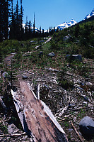
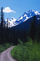
The logging road to the site is flat, but the alder is badly
encroaching on the road (think badly scratched car) so I parked about 3
km from the trail head and
hiked in. I was quite surprised to find a few cars had driven all
the way up (about 6km) and were scratched, but then I noticed some of
them were rentals.
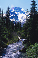
The trail itself (once you get to it) is actually quite nice. It
very quickly gets out of the logged area and pushes through high
altitude trees. There isn't much flagging tape (a few bits) and I
did once manage to loose the trail on a switchback, but no
complaints.
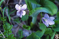
Along the way I found various flowers. The Marsh Marigolds were
strong and common wherever water crossed the path. After about 3
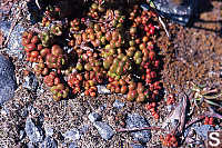
hours you find yourself in a boulder field (with a stream running
through it) and you start navigating by the cairn's left behind - a new
experience for me.
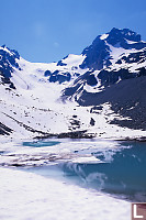
A bit more pushing up and you
enter the moon scape at
the bottom on the Glacier. There is a small tarn collecting the
run off and two large moraines left behind by the glacier when it was
much larger. I at lunch at the waters edge.
I poked around a little trying to find a good way up to the glacier
(one guide book says take the western moraine, the other suggests stay
away from it because of falling rock), but the direct approach is a lot
of work (climbing over rocks) and not particularly rewarding. I
have this romantic notion of a deeply fissured glacier with caves at the
toe, but this isn't that glacier.
The walk out is pretty much the same as the way in. When I got to
the road, I noticed the sky looking toward Lilooet had changed - a
forest fire from a day or two before had filled the sky with
smoke. I guess it means more cheap morels for next year.
Tags: mountain(3), plant(3), snow(3), rock(2), flower(2), road(2)
From: John Harvey Photo > John Harvey Photo - Hiking > Cerise Creek
Last Modified Saturday, January 21st, 2023 at 23:41:55 Edit
Copyright and Contact Information.