 |
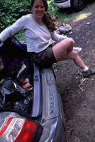 I had a Forester for a test drive for the weekend and I
thought a nice hike may be in order. We were looking for a pretty
short hike - perhaps a few hours, and a drive that would let me test the
car a little. Cheakamus canyon off the 99, between Seymour and Whistler
- beautiful country. The ride up from Vancouver was spectacular - the
Forester turns well, but is somewhat lacking in acceleration when the turbo
isn't there to help.
We drove the last few km down a dirt road (cottage access) and parked
next to the river.
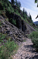 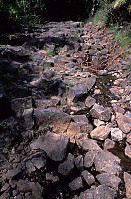
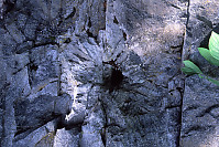
The first thing you notice is the rock. The hike starts next
to hills of broken rock - bubbly black rock with speckles of other colors.
This whole area was once the site of volcanic activity. Hiking further,
you come to a second of trail where you are walking on top of the hexagonal
lava columns - lava solidified in place in a cinder cone.
|
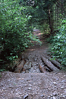 The trail itself is wide, capable
of (for the most part) supporting 4x4 vehicles. My hiking book says
this area was cut for the Pemberton Cattle Trail (survey first in 1873),
an unsuccessful (too difficult) route for driving cattle from the interior
(Lillooet) to Squamish for market. Now the road access is used for
access to Starvation lake (there were a few campers there when we arrived)
and possibly for power line maintenance.
The trail itself is wide, capable
of (for the most part) supporting 4x4 vehicles. My hiking book says
this area was cut for the Pemberton Cattle Trail (survey first in 1873),
an unsuccessful (too difficult) route for driving cattle from the interior
(Lillooet) to Squamish for market. Now the road access is used for
access to Starvation lake (there were a few campers there when we arrived)
and possibly for power line maintenance.
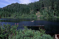
 Past Starvation lake
you get into the canyon views. Looking south you can see the beautiful
Tantalus Range - high, glacier covered peaks. A break in the forest
gives you the first clear views of the mountains the rail road - hugging
the canyon walls. The railway was built between 1912 and 1915, linking
Sqamish with the interior.
Past Starvation lake
you get into the canyon views. Looking south you can see the beautiful
Tantalus Range - high, glacier covered peaks. A break in the forest
gives you the first clear views of the mountains the rail road - hugging
the canyon walls. The railway was built between 1912 and 1915, linking
Sqamish with the interior.
 I found a small patch of tiger
lilies growing here. I'm a sucker for flowers so we stopped and took
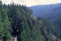
some pictures. From here the road becomes more tortured - it's blasted
out of the rock walls. You can see the mechanics of the road (retaining
logs, blast sites) as you hike further into the canyon.
I found a small patch of tiger
lilies growing here. I'm a sucker for flowers so we stopped and took
some pictures. From here the road becomes more tortured - it's blasted
out of the rock walls. You can see the mechanics of the road (retaining
logs, blast sites) as you hike further into the canyon.
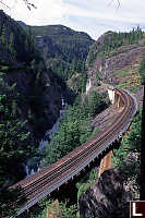
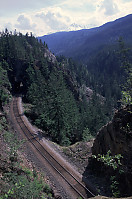
 And then you come tot he money shot - a large
curving railway bridge overlooking a falls in the Cheakamus canyon.
We hiked up to the large rock bluff and had lunch overlooking the falls.
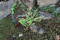
The plant life here is used to the dry sunny climate - it's different that
what you see in the forest earlier.
And then you come tot he money shot - a large
curving railway bridge overlooking a falls in the Cheakamus canyon.
We hiked up to the large rock bluff and had lunch overlooking the falls.
The plant life here is used to the dry sunny climate - it's different that
what you see in the forest earlier.
Overall, a very nice hike. We walked back to car and enjoyed the
sunny summer afternoon drive home.

