Previous Laying Anchor in Eucott Bay
7 of 19 from Cascade Inlet to Eucott Hot Springs
Next

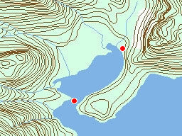
At first we tried anchoring in the secluded bay but for the first time ever, I saw
the bottom under the Curve of Time. Because the tides shift anchor's, we decided it would be
safer in the large, but more exposed bay outside. (I took this picture from the crows nest)


Date: Thursday, August 9th, 2001
Film: Fuji Velvia 50 (slide)
Lens: 28-70mm f/2.8 ED-IF AF-S Zoom-Nikkor
Location:
Laying Anchor in Eucott Bay Eucott Hot Spring When we Arrived Group in Eucott Hot Spring Laying Anchor in Eucott Bay Eucott Hot Spring When we Arrived Group in Eucott Hot Spring Laying Anchor in Eucott Bay Eucott Hot Spring When we Arrived Group in Eucott Hot Spring Alexander MacKenzie from Dean Channel Alex MacKenzie From Canada by Land 22d July 1793 Diagonal Falls Hanging Valley Laying Anchor in Eucott Bay Eucott Hot Spring When we Arrived Group in Eucott Hot Spring Alexander MacKenzie from Dean Channel Alex MacKenzie From Canada by Land 22d July 1793 Diagonal Falls Hanging Valley Laying Anchor in Eucott Bay Eucott Hot Spring When we Arrived Group in Eucott Hot Spring Link Lake Dam at Ocean Falls Log Sorting Yard Alexander MacKenzie from Dean Channel Alex MacKenzie From Canada by Land 22d July 1793 Diagonal Falls Hanging Valley Cabin at End of Cascade Inlet Laying Anchor in Eucott Bay Eucott Hot Spring When we Arrived Group in Eucott Hot Spring Curve of Time Driving By Link Lake Dam at Ocean Falls Lake Namu Wharf in Namu Jaques and Charles Kayaking Cultus Sound Anchorage Cedar Stained Ocean Bella Bella from the Ocean Boats in Bella Bella Harbour View of Shearwater Marina Accommodation in Shearwater Lake Namu Wharf in Namu Jaques and Charles Kayaking Cultus Sound Anchorage Cedar Stained Ocean Bella Bella from the Ocean Boats in Bella Bella Harbour View of Shearwater Marina Accommodation in Shearwater Lake Namu Wharf in Namu Jaques and Charles Kayaking Cultus Sound Anchorage Cedar Stained Ocean Bella Bella from the Ocean Boats in Bella Bella Harbour View of Shearwater Marina Accommodation in Shearwater New National Park Sign Yellow Iris With Ants Pink Spheres Downtown Vancouver From Stanley Park View Down Oak Street Burrard Street Bridge in Snow Sea Terminal,  South Terminal,  Main Terminal Of YVR On Approach To Mudge Hot Tub And House Stephen And His Sunset New National Park Sign Yellow Iris With Ants Pink Spheres Downtown Vancouver From Stanley Park View Down Oak Street Burrard Street Bridge in Snow Sea Terminal,  South Terminal,  Main Terminal Of YVR On Approach To Mudge Hot Tub And House Stephen And His Sunset Lake Namu Wharf in Namu Jaques and Charles Kayaking Cultus Sound Anchorage Cedar Stained Ocean Bella Bella from the Ocean Boats in Bella Bella Harbour View of Shearwater Marina Accommodation in Shearwater Lake Namu Wharf in Namu Jaques and Charles Kayaking Cultus Sound Anchorage Cedar Stained Ocean Bella Bella from the Ocean Boats in Bella Bella Harbour View of Shearwater Marina Accommodation in Shearwater Lake Namu Wharf in Namu Jaques and Charles Kayaking Cultus Sound Anchorage Cedar Stained Ocean Bella Bella from the Ocean Boats in Bella Bella Harbour View of Shearwater Marina Accommodation in Shearwater Lake Namu Wharf in Namu Jaques and Charles Kayaking Cultus Sound Anchorage Cedar Stained Ocean Bella Bella from the Ocean Boats in Bella Bella Harbour View of Shearwater Marina Accommodation in Shearwater New National Park Sign Yellow Iris With Ants Pink Spheres Downtown Vancouver From Stanley Park View Down Oak Street Burrard Street Bridge in Snow Sea Terminal,  South Terminal,  Main Terminal Of YVR On Approach To Mudge Hot Tub And House Stephen And His Sunset New National Park Sign Yellow Iris With Ants Pink Spheres Downtown Vancouver From Stanley Park View Down Oak Street Burrard Street Bridge in Snow Sea Terminal,  South Terminal,  Main Terminal Of YVR On Approach To Mudge Hot Tub And House Stephen And His Sunset
Map
Tag: coast
Larger Image: 1327 x 2000

John Harvey Photo > Map of the North Western North America > Mid Coast of BC on the Curve of Time > Cascade Inlet to Eucott Hot Springs > Laying Anchor in Eucott Bay
John Harvey Photo > John's Overnight Page > Mid Coast of BC on the Curve of Time > Cascade Inlet to Eucott Hot Springs > Laying Anchor in Eucott Bay
John Harvey Photo > Map of the North Western North America > Mid Coast of BC on the Curve of Time > Jenny Inlet to Cascade Inlet > Cascade Inlet to Eucott Hot Springs > Laying Anchor in Eucott Bay
John Harvey Photo > John's Overnight Page > Mid Coast of BC on the Curve of Time > Jenny Inlet to Cascade Inlet > Cascade Inlet to Eucott Hot Springs > Laying Anchor in Eucott Bay
John Harvey Photo > Map of the North Western North America > Mid Coast of BC on the Curve of Time > Shearwater to Codville Lagoon > Jenny Inlet to Cascade Inlet > Cascade Inlet to Eucott Hot Springs > Laying Anchor in Eucott Bay
John Harvey Photo > John's Overnight Page > Mid Coast of BC on the Curve of Time > Shearwater to Codville Lagoon > Jenny Inlet to Cascade Inlet > Cascade Inlet to Eucott Hot Springs > Laying Anchor in Eucott Bay
John Harvey Photo > Map of the North Western North America > Mid Coast of BC on the Curve of Time > Shearwater to Codville Lagoon > Shearwater to Codville Lagoon > Jenny Inlet to Cascade Inlet > Cascade Inlet to Eucott Hot Springs > Laying Anchor in Eucott Bay
John Harvey Photo > John's Overnight Page > Mid Coast of BC on the Curve of Time > Shearwater to Codville Lagoon > Shearwater to Codville Lagoon > Jenny Inlet to Cascade Inlet > Cascade Inlet to Eucott Hot Springs > Laying Anchor in Eucott Bay

Leave a Comment

Some HTML allowed: <b>, <code> <em> <i> <strike> <strong>, but most isn't.  Text length is limited.  Comments from first time authors will be reviewed before being posted. Comments with swearing or painfully poor spelling will probably be rejected.

Last Modified Tuesday, January 1st, 2008 at 15:49:45. Edit
Copyright and Contact Information.