Farwell Canyon

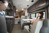
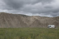
 First night in a RV!
We rented the RV on a Sunday afternoon with
the intention of packing Sunday night and leaving Monday
morning. We rented pretty bare bones - we had to provide all
of the kitchen stuff and bedding. On the plus side, we had a
large collection of camping gear so we just had to move stuff from
our storage room to the RV and we were surprised to discover how
much extra space we had! We packed jackets in closets,
bathroom supplies (16 rolls of special RV toilet paper) and
everything else we could think of. We brought our handy
non-stick frying pans from our home kitchen and a few jugs of
drinking water.
The next morning we got the kids in the camper and hit the road -
at 11am!
We had lunch in Abbotsford - our RV was too tall to go through
most drive throughs so we had to use "curbside" pickup. Our
first destination was a rock hounding site I wanted to try up past
Cache Creek. We had a brief drive on a dirt road and got to
place where we could mine for amethyst!
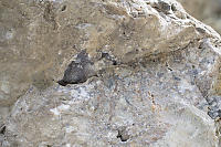
The rock was easy to find (right at the side of the road), but it
was low quality - almost no purple colour and very small
crystals. The real problem was the matrix - crystals were
solidly attached to surround stone which had very few
cracks. The only obvious option is to take either hit the
crysal (not a good plan) or follow a big crack and hope you can
take off something large. Neither works well.
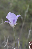
That said, getting off the highway and
moving slowly lets you see things you would normally miss.
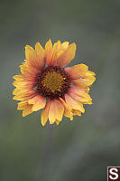
There was lots of cactus in the grass and most of it was
blooming. Prickly pear cactus is quite widespread in BC, but
this is the first time I've seen it blooming.
We didn't stay long (We had a long way to go still) so we got
turned around an continued North. In William lake we stopped
for take out and got to our destination - The historic Chilcotin
lodge - around 8pm. They are both a lodge (rooms for rent)
and a RV park for a dozen vehicles. We were the only guests
for the night.

The lodge has relatively new owners and while it's only 30 minutes
from Williams lake, you are out of the way here. There is no
cell phone signal and the lodge can only get ADSL - 1.5 Mbit or
lower. That said, there are birds everywhere and not a lot
of city noise.
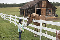
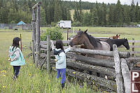
The owners have horses for their own riding (they don't offer
riding services) but they did give the kids an apple each so the
kids could feed the horses. The kids were thrilled!
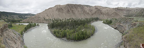
On the road again! We drove roughly 20 minutes to Farwell
Canyon and found it empty. We originally thought about just
camping at Farwell Canyon, but there are no services and it was
our first night so we wanted a bit of a safety net.
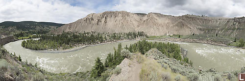
The view from the pull out is
amazing. The Chilcoot river is chewing its way through the
soft sediment which causes steep cliffs and lazy s-bends in the
river. The far side of the river has an enormous hillside
which has hoodoo's and a sand dune at the top.
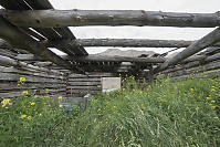
From the parking lot you can walk down to an old farmstead (which
is probably private property) or out to the cliff edge. We
decided to check out the old farmstead to see the view from below.
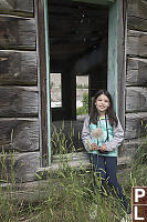
The buildings are log homes that are slowly
returning to nature. You definitely don't want to go inside
and the wood is likely rotting.
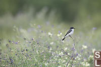
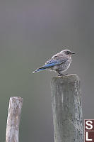
There is a field and an old apple tree which is still hanging on.
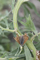
We spotted birds and butterflies calling this place
home.
Back at the vehicle, we walked out to the edge of the cliff.
In theory you could walk down to the river, but I'm not a big fan
of walking down steep sandy slopes as you might not be able to
walk back up!
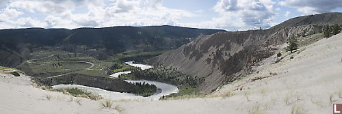
I really wanted to see the sand dune and the view from the
top. There is quite a nice trail with a trail head about a
km back towards the highway. We parked, loaded up our water
and started walking!


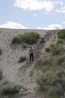
The hike is about 2km there with 160m of elevation change (says
AllTrails) - my little GPS says the elevation at the start and end
are almost identical. Most of the hike is on vehicle level
roads, but there are some parts climbing steep sand slopes where
progress is really slow.

The view from the top is amazing.
There was a constant breeze blowing sand up from below so the
patterns in the sand were untouched. The front (river
facing) side of the sand dune isn't steep so there isn't a risk of
falling in and becoming trapped.
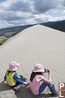

We stayed at the top and appreciated the
view of the river (and drank water).
But all good things - we decided to return back the way we
came. Going down a huge pile of sand is much faster than
going up. By the time we got back to the camper, we still
had a few sips of water in the water bottles. The air
conditioning in the camper was really really appreciated.
Tags: sand(3), derelict(3), horse(2), hand feeding(2), sand dune(2), fence(2)
People: Claira(4), Nara(2)
From: John Harvey Photo > John's Overnight Page > Prince Rupert Road Trip > Farwell Canyon
From: John Harvey Photo > John's Overnight Page > Farwell Canyon
Last Modified Sunday, January 22nd, 2023 at 00:07:29 Edit
Copyright and Contact Information.