Previous GPS Receivers
31 of 36 from Merritt trip - 50°N, 121°W Confluence Point
Next

mainimage

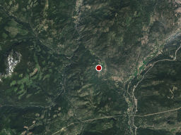
We are in a clear patch of bush about 15 feet from the confluence point.


Camera: Nikon F100
Date: Saturday, July 14th, 2001
Film: Fuji Velvia 50 (slide)
Lens: 28-70mm f/2.8 ED-IF AF-S Zoom-Nikkor
Location:
GPS Receivers GPS Receivers Bridges In Lytton Cisco Bridges Kids In Front Of Talking Rock Car Ferry On Fraser Bear Eating With Youth Crack Mined Out Fireweed Namesless Pond Tarn In Front Of Anniversary Glacier Smoke From Forest Fire GPS Receivers River Side Camp Site Skookumchuck Church of the Holy Cross Grave Stone First Lake Pano Helen Next To Tszil Glacier Pink Monkey Flowers Bridges In Lytton Church In Spences Bridge New National Park Sign Yellow Iris With Ants Sea Terminal,  South Terminal,  Main Terminal Of YVR On Approach To Mudge Big Windows Left Side of Cove Panoramic Reflecting Pond Retreat Island Sunset Four Otters Sea Lions on the Rocks New National Park Sign Yellow Iris With Ants On Approach To Mudge Reflecting Pond Four Otters Sandheads Lighthouse Ferry Terminal Dive Site Right Castle With Irises Mud Flats at Sunset Waiting For Lifts To Open New National Park Sign Yellow Iris With Ants On Approach To Mudge View From Second Chief Mud Flats at Sunset Waiting For Lifts To Open View From Lunch Tarn In Front Of Anniversary Glacier Mark And Mike At Summit Boat At Landing Boardwalk In Meadow New National Park Sign Yellow Iris With Ants Waiting For Lifts To Open Mark And Mike At Summit Boat At Landing Boardwalk In Meadow Rock Margin Front of Condo Fence at Rathtrevor Wharf in Namu Diagonal Falls New National Park Sign Waiting For Lifts To Open Mark And Mike At Summit Boat At Landing Front of Condo Wharf in Namu Immature Bog Cranberry Numa Falls (Veiled) Athabasca Falls Closer Bromley Rock Mount Robson In Fog GPS Receivers Start of Hike Mark And Mike At Summit GPS Receivers Green Lake Manning Vista Lightning Lake Pano Rows Of Daffodils Start of Hike Hot Water Waterfall Moon Over Mountains Us In Front Of Tunnel Bee On Stonecrop New National Park Sign Yellow Iris With Ants Sea Terminal,  South Terminal,  Main Terminal Of YVR On Approach To Mudge Big Windows Left Side of Cove Panoramic Reflecting Pond Retreat Island Sunset Four Otters Sea Lions on the Rocks New National Park Sign Yellow Iris With Ants On Approach To Mudge Reflecting Pond Four Otters Sandheads Lighthouse Ferry Terminal Dive Site Right Castle With Irises Mud Flats at Sunset Waiting For Lifts To Open New National Park Sign Yellow Iris With Ants On Approach To Mudge View From Second Chief Mud Flats at Sunset Waiting For Lifts To Open View From Lunch Tarn In Front Of Anniversary Glacier Mark And Mike At Summit Boat At Landing Boardwalk In Meadow New National Park Sign Yellow Iris With Ants Waiting For Lifts To Open Mark And Mike At Summit Boat At Landing Boardwalk In Meadow Rock Margin Front of Condo Fence at Rathtrevor Wharf in Namu Diagonal Falls New National Park Sign Waiting For Lifts To Open Mark And Mike At Summit Boat At Landing Front of Condo Wharf in Namu Immature Bog Cranberry Numa Falls (Veiled) Athabasca Falls Closer Bromley Rock Mount Robson In Fog
Map
Photographer: John Harvey
Tag: tool
Larger image: 1329 x 2000

John Harvey Photo > John Harvey Photo - Camping > Merritt trip - 50°N, 121°W Confluence Point > GPS Receivers

Leave a Comment

Some HTML allowed: <b>, <code> <em> <i> <strike> <strong>, but most isn't.  Text length is limited.  Comments from first time authors will be reviewed before being posted. Comments with swearing or painfully poor spelling will probably be rejected.

Last Modified Saturday, January 21st, 2023 at 23:39:13. Edit
Copyright and Contact Information.